![](/images/other/stat-length.png)
GR_70_AG_07_Mont-Lozere-Goulet_Cubieres_20140921
patrickdanilo
Utilisateur
![Longueur](/images/other/stat-length.png)
Longueur
19,8 km
![Altitude max](https://static1.geolcdn.com/siteimages/upload/files/1508320355ic_sort_altitude_max_24dp.png)
Altitude max
1418 m
![Dénivelé positif](https://static1.geolcdn.com/siteimages/upload/files/1508320355ic_sort_den_pos_24dp.png)
Dénivelé positif
802 m
![Km-Effort](/images/other/stat-length.png)
Km-Effort
30 km
![Altitude min](https://static1.geolcdn.com/siteimages/upload/files/1508320355ic_sort_altitude_min_24dp.png)
Altitude min
1063 m
![Dénivelé négatif](https://static1.geolcdn.com/siteimages/upload/files/1508320355ic_sort_den_neg_24dp.png)
Dénivelé négatif
538 m
![Boucle](https://static1.geolcdn.com/siteimages/upload/files/16400158638029165_repeat_loop_refresh_sync_direction_icon.png)
Boucle
Non
Date de création :
2018-02-11 00:00:00.0
Dernière modification :
2022-11-02 14:53:14.379
![Marche](https://static1.geolcdn.com/sitytour/trail-icons/101.png)
6h12
Difficulté : Très difficile
![Scannez ce code QR pour ouvrir la randonnée dans l'application SityTrail](https://capi.geolives.com/qq0zvz2zws4bq2lad0pu/sitytour/trails/352210/qr.png?size=200)
Application GPS de randonnée GRATUITE
À propos
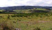
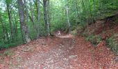
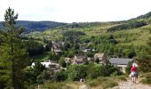
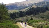
Randonnée Marche de 19,8 km à découvrir à Occitanie, Lozère, Mont Lozère et Goulet. Cette randonnée est proposée par patrickdanilo.
Description
Randonnée Marche de 19 km à découvrir à Mont Lozère et Goulet, Lozère, Occitanie. Cette randonnée est proposée par patrickdanilo
Localisation
Pays :
France
Région :
Occitanie
Département/Province :
Lozère
Commune :
Mont Lozère et Goulet
Localité :
Chasseradès
Départ:(Dec)
Départ:(UTM)
563794 ; 4932342 (31T) N.
Commentaires
Randonnées à proximité
![Randonnée Marche Mont Lozère et Goulet - 12-05-2023 E7 Bonnetés - Le Pont de Monvers - Photo](https://media.geolcdn.com/t/375/260/d16bfac8-7ce8-4044-a757-ffb026543eb4.jpg&format=jpg&maxdim=2)
![Marche Marche](https://static1.geolcdn.com/sitytour/trail-icons/101.png)
12-05-2023 E7 Bonnetés - Le Pont de Monvers
Marche
Difficile
Mont Lozère et Goulet,
Occitanie,
Lozère,
France
![](/images/other/stat-length.png)
25 km | 35 km-effort
7h 59min
![](https://static1.geolcdn.com/siteimages/upload/files/16400158638029165_repeat_loop_refresh_sync_direction_icon.png)
Non
![Randonnée Marche Mont Lozère et Goulet - Stevenson étape 7 - Photo](https://media.geolcdn.com/t/375/260/ca5e79f2-b988-472d-b1a4-865ced3314e1.jpg&format=jpg&maxdim=2)
![Marche Marche](https://static1.geolcdn.com/sitytour/trail-icons/101.png)
Stevenson étape 7
Marche
Difficile
Mont Lozère et Goulet,
Occitanie,
Lozère,
France
![](/images/other/stat-length.png)
20 km | 28 km-effort
4h 57min
![](https://static1.geolcdn.com/siteimages/upload/files/16400158638029165_repeat_loop_refresh_sync_direction_icon.png)
Non
![Randonnée Marche Mont Lozère et Goulet - Stevenson Chasseradès - Le Bleymard - Photo](https://media.geolcdn.com/t/375/260/084f4a90-f605-49e0-8cc1-95e8aee0296f.jpg&format=jpg&maxdim=2)
![Marche Marche](https://static1.geolcdn.com/sitytour/trail-icons/101.png)
Stevenson Chasseradès - Le Bleymard
Marche
Très difficile
Mont Lozère et Goulet,
Occitanie,
Lozère,
France
![](/images/other/stat-length.png)
21 km | 29 km-effort
5h 4min
![](https://static1.geolcdn.com/siteimages/upload/files/16400158638029165_repeat_loop_refresh_sync_direction_icon.png)
Non
![Randonnée Marche Mont Lozère et Goulet - le Bleymard - Photo](https://media.geolcdn.com/t/375/260/a7e52d95-c918-4024-aa49-8bd4f60cbf65.jpg&format=jpg&maxdim=2)
![Marche Marche](https://static1.geolcdn.com/sitytour/trail-icons/101.png)
le Bleymard
Marche
Très difficile
Mont Lozère et Goulet,
Occitanie,
Lozère,
France
![](/images/other/stat-length.png)
17,3 km | 25 km-effort
5h 14min
![](https://static1.geolcdn.com/siteimages/upload/files/16400158638029165_repeat_loop_refresh_sync_direction_icon.png)
Non
![Randonnée Marche Mont Lozère et Goulet - Chasserades Bleymard - Photo](https://media.geolcdn.com/t/375/260/116a16c1-813e-45da-b910-05ff52927fe4.jpg&format=jpg&maxdim=2)
![Marche Marche](https://static1.geolcdn.com/sitytour/trail-icons/101.png)
Chasserades Bleymard
Marche
Difficile
Mont Lozère et Goulet,
Occitanie,
Lozère,
France
![](/images/other/stat-length.png)
20 km | 28 km-effort
6h 57min
![](https://static1.geolcdn.com/siteimages/upload/files/16400158638029165_repeat_loop_refresh_sync_direction_icon.png)
Non
![Randonnée Marche Mont Lozère et Goulet - arsel chasserades au bleymard - Photo](https://media.geolcdn.com/t/375/260/93179cba-083a-4533-8ddb-80481acfe8eb.jpg&format=jpg&maxdim=2)
![Marche Marche](https://static1.geolcdn.com/sitytour/trail-icons/101.png)
arsel chasserades au bleymard
Marche
Très facile
Mont Lozère et Goulet,
Occitanie,
Lozère,
France
![](/images/other/stat-length.png)
14,1 km | 21 km-effort
6h 14min
![](https://static1.geolcdn.com/siteimages/upload/files/16400158638029165_repeat_loop_refresh_sync_direction_icon.png)
Non
![Randonnée V.T.T. Mont Lozère et Goulet - Chasserades Finiels 2020 - Photo](https://media.geolcdn.com/t/375/260/6b5f0140-2a52-469f-ac07-12640915fb18.jpg&format=jpg&maxdim=2)
![V.T.T. V.T.T.](https://static1.geolcdn.com/sitytour/trail-icons/202.png)
Chasserades Finiels 2020
V.T.T.
Difficile
Mont Lozère et Goulet,
Occitanie,
Lozère,
France
![](/images/other/stat-length.png)
48 km | 67 km-effort
5h 36min
![](https://static1.geolcdn.com/siteimages/upload/files/16400158638029165_repeat_loop_refresh_sync_direction_icon.png)
Non
![Randonnée Marche Cubières - E7 Les Alpiers - Pont de Montvert GR70 - Photo](https://media.geolcdn.com/t/375/260/a19b68b9-07c3-416e-95e6-0c62d1288eb4.jpg&format=jpg&maxdim=2)
![Marche Marche](https://static1.geolcdn.com/sitytour/trail-icons/101.png)
E7 Les Alpiers - Pont de Montvert GR70
Marche
Difficile
Cubières,
Occitanie,
Lozère,
France
![](/images/other/stat-length.png)
24 km | 34 km-effort
6h 20min
![](https://static1.geolcdn.com/siteimages/upload/files/16400158638029165_repeat_loop_refresh_sync_direction_icon.png)
Non
![Randonnée Marche Mont Lozère et Goulet - Chasserades -Station Mont Lozère Stevenson - Photo](https://media.geolcdn.com/t/375/260/ext.jpg?maxdim=2&url=https%3A%2F%2Fservices.sitytrail.com%2FGeolivesWS%2FDownloadMedia.ashx%3FTrailID%3D769906%26Media%3Dfix__20170609174625.jpg)
![Marche Marche](https://static1.geolcdn.com/sitytour/trail-icons/101.png)
Chasserades -Station Mont Lozère Stevenson
Marche
Difficile
(1)
Mont Lozère et Goulet,
Occitanie,
Lozère,
France
![](/images/other/stat-length.png)
25 km | 37 km-effort
7h 47min
![](https://static1.geolcdn.com/siteimages/upload/files/16400158638029165_repeat_loop_refresh_sync_direction_icon.png)
Non